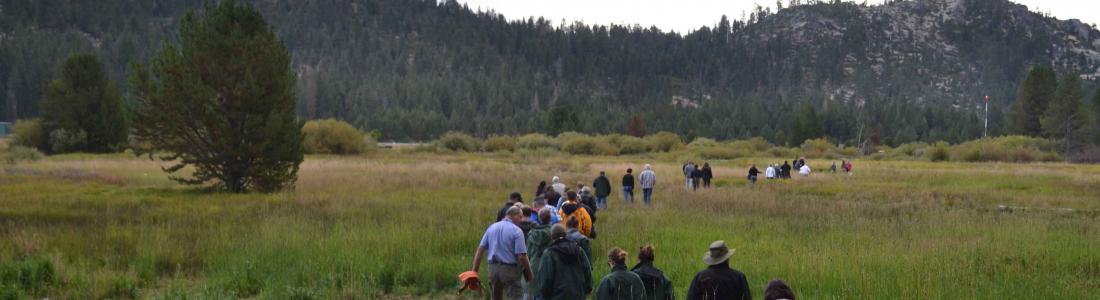
Watch our series of short videos on the importance of the
Sacramento-San Joaquin Delta, how it works as a water hub for
California and the challenges it is facing.
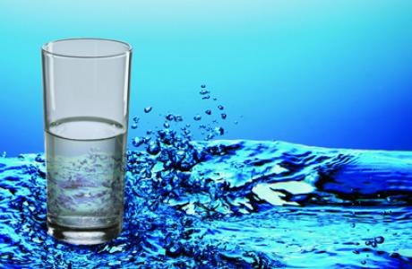
Some people in California and across the West struggle to access
safe, reliable and affordable water to meet their everyday needs
for drinking, cooking and sanitation.
There are many ways to support our nonprofit mission by donating
in someone’s honor or memory, becoming a regular contributor or
supporting specific projects.
As atmospheric rivers blasted across California this year, they
brought epic amounts of rain and snow follwing a three-year
drought.
Devastating and deadly floods hit parts of the state and now all
eyes are on the potential for more flooding, particularly in
the San Joaquin Valley as the record amount of snow in the
Sierras melts with warmer temperatures.
With anticipated sea level rise and other impacts of a changing
climate, flood management is increasingly critical in California.
Big Day of Giving is just around
the corner! Your donation helps support scholarships for
our tours, events &
workshops, expand Project WET teacher trainings
throughout California, provide free public access to
our Western
Water news coverage, updates to our
Layperson’s
Guides and more!
Donate todayor anytime
through May 2 to help us reach our fundraising goal
of $15,000!
There is no need to wait to show
your love for the Water Education Foundation! Starting today, you
can donate to our Big Day of Giving campaign and help us reach
our fundraising goal of $15,000 by May 2.
Big Day of Giving is a 24-hour online fundraising marathon
for nonprofits. Donations will benefit our programs and
publications across California and the
West.
The Bureau of Reclamation announced Wednesday that
south-of-Delta water contractors are having their water
allocation increase from 35 percent to 40 percent of their
contracted amount. That five percent increase was
“incredibly disappointingly low” for Westlands Water
District. The big picture: South-of-Delta contractors
were initially allocated 15 percent of their contracted total
in February, but that number was boosted to 35 percent in
March. Farmers were hopeful that California’s above
average snowpack would result in a greater boost, considering
the state has had a good start to the year with precipitation.
Conservationists lost an appeal to the Ninth Circuit on
Wednesday as they attempted to force the federal government to
reconsider climate change studies in managing the Glen Canyon
Dam and Colorado River. Save the Colorado, Living River and the
Center for Biological Diversity initially asked the U.S.
Department of the Interior to consider emerging climate science
and the severe potential of climate change in updating its
management plan in 2016 for the Glen Canyon Dam on Lake Powell,
which has a water level 3,564 feet above sea level.
… [The judges] concluded that the Interior did not
violate environmental law when developing its 20-year plan for
managing water releases from the dam or the plan’s accompanying
environmental analysis.
Long-term weather models are hinting a wet storm could sweep
California in early May, but forecasters warn that people
shouldn’t arrange their plans around this potential system just
yet. On Tuesday, the National Weather Service’s Weather
Prediction Center told SFGATE that some models show the storm
could generally bring a chance of 0.5 to 1 inch of rain across
the entire state. An inch of rain is not a big deal in the
winter, but in May, it’s a little less typical.
… Weather models show the storm potentially arriving May
4, with rain chances continuing into Monday, May 6. Oravec
shared this information with a big caveat: The timing of the
storm is likely to change in the coming days, or the entire
forecast could shift.
Make a Splash with a Big Day of Giving Gift!
Big Day of Giving is just around the corner! Your donation
helps support scholarships for our tours, events & workshops,
expand Project
WET teacher trainings throughout California,
provide free public access to our Western Water and
Aquafornia news
coverage, updates to our Layperson’s Guides
and more!
Donatetoday or anytime
through May 2 to help us reach our fundraising
goal of $15,000! As part of the Big Day of Giving
campaign, we are hosting our annual open house and
reception May 2. Join us at our office near the
Sacramento River to meet our team and learn more about our
work.
As the date of reckoning for excessive groundwater pumping in
Tulare County grows closer, lobbying by water managers and
growers has ramped up. The Friant Water Authority, desperate to
protect its newly rebuilt – yet still sinking –
Friant-Kern Canal, has beseeched the Water Resources Control
Board to get involved. Specifically, it has asked board members
to look into how the Eastern Tule Groundwater Sustainability
Agency (GSA) has, or has not, curbed over pumping that affects
the canal. Meanwhile, the Eastern Tule groundwater agency has
been doing a bit of its own lobbying. It recently hosted all
five members of the Water Board on three separate tours of the
region, including the canal. Because the tours were staggered,
there wasn’t a quorum of board members, which meant they
weren’t automatically open to the public.
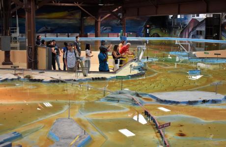
Operated by the U.S. Army Corps of Engineers, the
Bay Model is a giant hydraulic replica of San Francisco
Bay and the Sacramento-San Joaquin
Delta. It is housed in a converted World II-era
warehouse in Sausalito near San Francisco.
Hundreds of gallons of water are pumped through the
three-dimensional, 1.5-acre model to simulate a tidal ebb
and flow lasting 14 minutes.
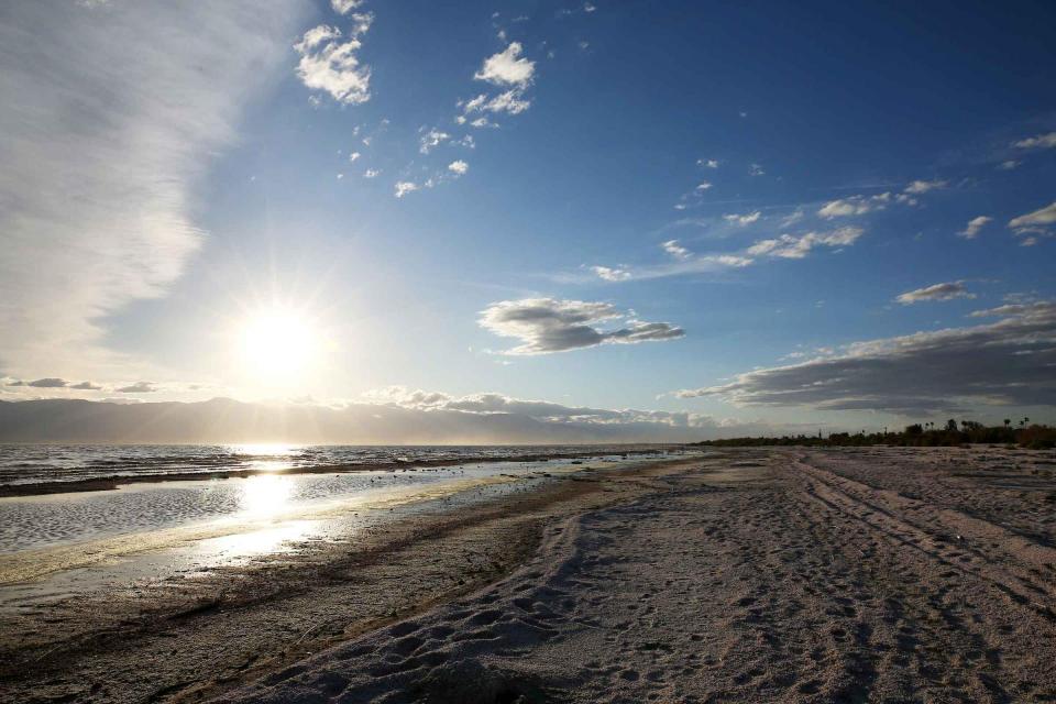
As part of the historic Colorado
River Delta, the Salton Sea regularly filled and dried for
thousands of years due to its elevation of 237 feet below
sea level.
The most recent version of the Salton Sea was formed in 1905 when
the Colorado River broke
through a series of dikes and flooded the seabed for two years,
creating California’s largest inland body of water. The
Salton Sea, which is saltier than the Pacific Ocean, includes 130
miles of shoreline and is larger than Lake Tahoe.