A watershed is a land area that helps drain runoff (snowmelt and
rain) into a diverse system of lakes, streams, rivers, and other
waterways.
Watersheds may be as small as a patch of land draining into a
tiny pond or as large as the Sacramento River Basin, which drains
an area about 27,000 square miles.
Watersheds follow natural boundaries and are usually separated
from one another by ridges or mountains. A watershed has many
important natural functions. It collects water from
precipitation, stores groundwater in aquifers, releases
water as runoff and provides habitat for plants and animals.
As it does every year, the U.S. Fish & Wildlife Service (FWS)
will be evaluating plant and animal species to determine which
ones deserve federal protection under the Endangered Species
Act. About half of the species chosen for analysis so far in
2024 have something in common: Their futures depend on the
conservation of wetlands. A mere coincidence? Probably
not. While wetlands cover just 6 percent of the earth’s
land surface area, they provide habitat for a whopping 40
percent of plants and animals. In all likelihood, we can
expect this trend of wetland-dependent species coming under the
protection of the Endangered Species Act to continue, predicts
Amy McNamara, a freshwater ecosystems strategist for NRDC. But
this, she says, “is something that we should work to avoid at
all costs.”
Last fall, UC Riverside’s Dr. Hoori Ajami co-authored a study
looking at how long-term droughts are impacting river flows
across the US. We asked Dr. Ajami and The Nature Conservancy’s
lead river scientist, Dr. Bronwen Stanford, to tell us about
the study and its implications. First, what is a “baseflow
drought” and how is it distinct from a precipitation drought?
Hoori Ajami: Water in a stream has two sources: precipitation
and groundwater. “Baseflow” is groundwater’s contribution to a
stream’s flow. We were specifically interested to see how a
river’s baseflow changes after a precipitation drought. …”
For the past two years, Mt. Shasta has emerged from winter
covered in thick blankets of white snow that conceal what
decades of drought have done to the Northern California
mountain’s ancient glaciers. The seasonal snows come and go on
the 14,179-foot peak. For hundreds of years, the glaciers have
clung to the mountain’s steep slopes, slowly changing and
moving over time. But for the past few decades, droughts and
periods of abnormally warm weather have caused the glaciers to
shrink. Scientists have studied the glaciers and documented
their demise as climate change — with its warmer temperatures
and dearth of snow — has slowly caused Mt. Shasta’s glacial
masses to dwindle, especially during the 2020-22 drought.
Atmospheric river storms are like punches in a boxing match. A
flurry of weak ones are OK. But it’s best to avoid the big
knockout blows. That’s exactly what happened in California this
winter. Scientists say that from Oct. 1 to April 1, the state
actually received more atmospheric rivers, the famous
moisture-laden meteorological events that are critical to the
water supply, than it did last year — 44 this winter compared
to 31 last winter. But the intensity made all the difference.
Statewide, California had just 2 strong atmospheric rivers this
winter, compared with 7 last year. Many of the biggest this
winter hit Washington and Oregon instead. The result was, for
the most part, a remarkably, blissfully average rainy season
for California. 3 were moderate and 7 were strong. This year,
26 were weak, 16 were moderate and 2 were strong.
California WaterBlog is a long-running outreach project from
the UC Davis Center for Watershed Sciences, a research center
dedicated to interdisciplinary study of water challenges,
particularly in California. We focus on environmentally and
economically sustainable solutions for managing rivers, lakes,
groundwater, and estuaries. This week, for UC Davis Give Day
(April 19-20) we’re sharing a little about the Center and the
work we do. I’m Karrigan Bork, the Center’s Interim Director,
helping out while Director Andrew Rypel is on sabbatical, and
I’ll be your guide for this brief tour through the “Shed”. If
you would like to donate to help the Center continue important
work, I’ve shared our giving link below.
Since the founding of Sacramento, residents have treasured the
beauty of the American River while living in fear of its
destructive power. Were the American to defy its man-made banks
in a series of historic storms, hundreds of thousands of
residents would face a flood disaster modern-day Sacramento has
never seen. The more we try to tame the river — as when the
Folsom Dam was constructed in 1955 to deny the river its
floodplain — the more we disfigure it. This ugly trade-off has
marked the passage of time in Sacramento and is as central to
the essence of this community as the state Capitol or the Tower
Bridge. A proposal to shore up some erosion spots along the
lower American River is the most recent flashpoint in the
trade-off between public safety and nature. -Written by Tom Philip, Sacramento Bee columnist.
… Scientists at Lawrence Berkeley National Laboratory
(Berkeley Lab) recently conducted a study … finding that more
intense atmospheric rivers are more likely to occur in
succession within a short period of time. … California’s
winter climate is largely defined by these atmospheric rivers –
long, narrow regions in the atmosphere that transfer water
vapor from the tropics, most commonly associated with the West
Coast coming from the Pacific Ocean. When they make landfall,
they can release massive amounts of rain and snow.
Record-breaking heat waves, severe floods and acute wildfires,
exacerbated by climate change, carry a colossal price tag: an
approximately 19% reduction in global income over just the next
26 years, a new study published Wednesday found. That financial
gut punch won’t just affect big governments and corporations.
According to the United Nations, the world is heading toward a
gain of nearly 3 degrees of global warming in the next century,
even with current climate policies and goals – and researchers
say individuals could bear the economic burden. The researchers
in Wednesday’s study, published in Nature, said financial pain
in the short-term is inevitable, even if governments ramp up
their efforts to tackle the crisis now.
El Dorado County is requesting public input while it develops
the Tahoe El Dorado (TED) Area Plan. The TED Area Plan is a
long-term planning document that will update and incorporate
the Meyers Area Plan and other communities in the Tahoe Basin
area of the County. The density, look, and character of a
community are defined by a variety of land use planning
documents. In the Tahoe Basin, land use falls under the El
Dorado County Zoning Ordinance and the Tahoe Regional Planning
Agency’s Regional Plan. Currently, the land use policies and
zoning designations in some areas conflict with each other.
This creates confusion about what is allowed and what can be
built on these properties. Conflicting land use policies
constrain new projects on those sites.
Insurers in California have sounded the alarm: A warming
climate has dramatically raised the risk of devastating
wildfires, and with it the cost of providing coverage. But now
a Peninsula lawmaker says those insurance companies should
credit the state and homeowners for the work done to reduce our
vulnerability to wildfires. State Sen. Josh Becker, a Menlo
Park Democrat, has introduced a bill that would require
insurers to consider the state’s efforts to thin flammable
brush and trees as well as property owners’ steps to make their
homes more fire resistant, such as covering vents and clearing
vegetation. Those efforts would need to be incorporated into
their risk modeling to determine coverage decisions and costs.
If you’re like us, you’re inspired by the natural world and
eager to see California’s beautiful mountains, forests, and
lakes protected for future generations. You also might be
surprised to hear that the health and survival of these places
depends on one species more than most: beavers. Put simply,
beavers are our partners in protecting and restoring
California. Beavers are known as a “keystone species,” meaning
they create, modify, and maintain critical ecosystems for
insects, birds, mammals, fish, plants, and trees. -Written by Kate Lundquist and Brock Dolman,
Co-Directors of the Watershed Advocacy, Training, Education, &
Research (WATER) Institute and the Bring Back the Beaver
Campaign at the Occidental Arts & Ecology Center.
Spring is a time of rebirth and renewal. And this season, Tahoe
is witnessing its own rebirth in the form of a species of bird
that had been previously driven out of the region. Sandhill
cranes are making an unexpected return to the Lake Tahoe basin
after a century long hiatus caused by overhunting. The birds
stand at about 4 feet tall with a wingspan of 7 feet and boast
a signature red patch on their head. The sandhill cranes are
often compared to dinosaurs by those lucky enough to witness
them due to their large size and loud croaks.
California’s Death Valley, the driest place in North America,
has hosted an ephemeral lake since late 2023. A NASA-led
analysis recently calculated water depths in the temporary lake
over several weeks in February and March 2024, demonstrating
the capabilities of the U.S.-French Surface Water and Ocean
Topography (SWOT) satellite, which launched in December 2022.
The analysis found that water depths in the lake ranged from
about 3 feet (1 meter) to less than 1.5 feet (0.5 meters) over
the course of about 6 weeks. This period included a series of
storms that swept across California, bringing record amounts of
rainfall.
A Supreme Court decision that stripped protections from
America’s wetlands will have reverberating impacts on rivers
that supply drinking water all over the U.S., according to a
new report. The rivers of New Mexico are among the waterways
that will be affected most by the May 2023 Supreme Court
decision in Sackett v. EPA, which rolled back decades of
federal safeguards under the Clean Water Act for about half of
the nation’s wetlands and up to four million miles of streams
that supply drinking water for up to four million people,
according to the report, titled “America’s Most Endangered
Rivers of 2024.” … [The report, issued by the advocacy group
American Rivers, also cited the Trinity River in
California and the Tijuana River in California and Mexico as
among the ten most endangered rivers.]
Near the western tip of the Mojave Desert and a few miles west
of NASA’s Armstrong Flight Research Center, fields of
wildflowers painted the landscape yellow in spring 2024. On
April 9, the OLI (Operational Land Imager) on the Landsat 8
satellite acquired this image of fields of yellow wildflowers
blanketing Antelope Valley amid solar and wind farms. The day
after the image was acquired, the Antelope Valley California
Poppy Reserve reported that wildflowers were “popping,” but the
region’s famous poppies were not. Rangers at the reserve said
they also saw very few small poppy plants maturing, suggesting
an impressive poppy bloom is unlikely in the coming weeks.
Four years ago, over 97% of Big Basin Redwoods State Park in
Santa Cruz County burned during the state’s worst wildfire
season in recorded history. Last year, unprecedented winter
storms caused an estimated $190 million in damages to coastal
parks. And at Seacliff State Beach, also in Santa Cruz County,
storms flooded the campground and destroyed the beach’s
historic pier. Climate change and the resulting severe
wildfires, extreme storms and rising sea levels are
increasingly threatening our beloved state parks. … To
address this unprecedented threat, we need to create
climate-resilient state parks that can prepare for, adapt to
and recover from climate impacts. -Written by Rachel Norton, the executive director
of the California State Parks Foundation.
The U.S. Environmental Protection Agency (EPA) today announced
a proposed settlement with Shasta-Siskiyou Transport of
Redding, Calif. to resolve claims of Clean Water Act (CWA)
violations after one of the company’s trucks overturned and a
fuel product spilled into storm drains in downtown Redding. The
fuel reached the Sacramento River. The proposed settlement
requires Shasta-Siskiyou Transport to pay a civil penalty of
$208,840. … On Jan. 21, 2022, one of Shasta-Siskiyou
Transport’s trucks was transporting transmix, a mixture of
gasoline, diesel fuel, and other petroleum distillates, when
the truck overturned in downtown Redding, releasing transmix
into nearby storm drains, which led directly to Calaboose Creek
and subsequently into the Sacramento River.
Erica Gies has always cared deeply about water. … Today, Gies
is an award-winning independent journalist and author who has
covered sustainability and water in outlets like The New York
Times, Scientific American, Nature, The Economist, and National
Geographic … River Partners sat down with Gies recently to
talk about bringing back floodplains, the importance of native
seeds and plants in restoration, what California is doing—and
what it could be doing—in managing water, and how optimistic
she is that we can thrive in an era of weather whiplash.
Even though Pacific storms have become less frequent, as is
often the case in April, a new storm is brewing and will slice
across California just in time for the weekend, bringing areas
of rain, mountain snow and much cooler air, AccuWeather
meteorologists say. … A storm over the Gulf of Alaska will
drop southward just off the coast into Friday and will swing
toward California this weekend. … A few inches to
perhaps a foot of snow may fall over the high country of the
Sierra Nevada from the weekend storm.
The Upper Truckee River Watershed is the largest contributor of
freshwater to Lake Tahoe. … With fewer floodplains, more fine
sediment and nutrients began flowing in, and the lake’s clarity
declined from more than 130 feet in the 1960s to a low point of
60 feet in 2017. … Once a healthy wetland, the property
is paved with asphalt, housing a defunct Motel 6 and a
long-shuttered restaurant. During the next several years,
the buildings will be razed, the asphalt removed and the
wetland restored, connecting 560 acres of the Upper Truckee
Marsh on the shores of Lake Tahoe to 206-acre Johnson Meadow
across Highway 50 to the south. It’s all part of a bigger
effort to restore the lake’s clarity by reclaiming habitat
around the 9 miles of the river closest to Lake Tahoe, an area
that has seen heavy development.
As the burning of fossil fuels and other human activities
continue to increase the levels of carbon dioxide in the
atmosphere, the ocean is absorbing a large portion of the CO2,
which is making seawater more acidic. … And here’s one
important fact about ocean acidification: It’s not happening at
the same rate everywhere. The California coast is one of the
regions of the world where ocean acidification
is occurring the fastest. … In particular, effluent
discharged from coastal sewage treatment plants, which has high
nitrogen levels from human waste, has been shown to
significantly contribute to ocean acidification off the
Southern California coast.
After being sanctioned by federal regulators for plowing up
protected wetlands on his California farm, a U.S. lawmaker is
now spearheading an effort to roll back federal water
protections — including the very same provisions that he once
paid penalties for violating. If the scheme is successful,
environmental groups say industrial polluters could more freely
contaminate wetlands, rivers, and other waters, harming both
the nation’s water resources and the communities depending on
them. It could also benefit the lawmaker spearheading the
attack, since he still owns the farm where he was found to be
destroying wetlands.
Chiquita Canyon Landfill has drawn more than 10,000 complaints,
a number of lawsuits and calls for it to close from residents
and elected officials and is allegedly dumping untreated
stormwater into local waterways, according to a complaint
issued this week by state water officials. The L.A.
Regional Water Quality Control Board issued another violation
Tuesday against Chiquita Canyon Landfill, after Castaic and Val
Verde residents sent the agency numerous photos of the landfill
allegedly pumping from its stormwater basin into the local
waterway at night. Multiple photos were posted to local social
media groups as well.
The California Department of Transportation (Caltrans) begins
construction this month to install a trash capture device along
northbound State Route 99, preventing trash in storm water
runoff from entering the Tuolumne River at Zeff Road. The trash
capture system will be located at the inlet of two existing
culverts on the southeast side of SR-99 and the Tuolumne River,
a location identified as a significant trash generating area.
The project will help the department achieve zero trash from
stormwater discharge into the lower reaches of the Tuolumne
River. It is consistent with the Caltrans’ Statewide Trash
Implementation plan and in compliance with the State Water
Resource Control Board water quality objectives for trash
pollutants.
After 12 years of planning, gathering funding then completing
and re-doing – and re-doing again – environmental studies, the
City of Bakersfield has finally gone out to bid for the
northern extension of the Kern River Parkway Trail. “I’m very
excited, it’s been a long time coming,” Councilman Bob Smith
said of the 6-mile long addition to the nearly 40-mile-long
path that runs the length of the Kern River from Gordon’s Ferry
on the east all the way to the Buena Vista Lake Aquatic
Recreation Area on the west. This extension will take runners,
hikers and cyclists north at Coffee Road along the Friant-Kern
Canal up to 7th Standard Road, about a half mile west of the
Gossamer Grove development.
… This marked the second year in a row with above-average
snowfall and was a huge turnaround from conditions at the
beginning of 2024, when the snowpack across the state was
barely a quarter of the historic average. … The
relationship between snowfall and climate change is not as
simple as it might first appear. Though rising temperatures
will cause some would-be snow to fall as rain, this is partly
balanced out by the fact that precipitation will become more
intense overall, since warmer air can hold more water vapor.
Some parts of Alaska and Northern Canada have
seen increases in snowfall over the last 40 years; in
these frigid locales the amount of snow is more limited by cold
weather, which decreases the amount of moisture in the air. -Written by Ned Kleiner, a scientist and catastrophe
modeler at Verisk.
… So what kind of fire season are we in for this year? Like
2023, this year has been a wet one. … After the wet
winter, vegetation in the state isn’t as parched as it would be
during a drought, so wildfire activity is likely to be pretty
low in the spring and early summer, Daniel Swain, a climate
scientist at the University of California, Los Angeles, said in
an online briefing this week. … But the year probably
won’t stay as quiet as 2023 was. This year’s wet weather hasn’t
been as extreme as last year’s — some inland cities, like
Fresno and South Lake Tahoe, actually received less rain
than usual this year — so plants and soil are more likely
to dry out over the rest of this year than they were last year.
“I would be somewhat surprised if this year was not
significantly more active,” Swain said.
In an April 1, 2024 letter to three water boards, fishing and
conservation groups and the Winnemem Wintu Tribe urged
regulators to control recently measured excess levels of
selenium in Mud Slough. Mud Slough drains selenium-impaired
land on the west side of the San Joaquin Valley into the San
Joaquin River and ultimately San Francisco Bay.
… Selenium has long been known to cause
reproductive failure, deformities, and death in fish and
waterfowl, according to a statement from the California
Sportfishing Protection Alliance (CSPA). “Our groups have
spent over a decade at the water boards and in court trying to
bring runoff from Mud Slough into compliance with water quality
standards,” said Chris Shutes, Executive Director of the
California Sportfishing Protection Alliance.
It was an average year for Colorado’s snowpack — and that’s
great news. The statewide snowpack sat at 109% of the
30-year median on Wednesday, just a few days shy of the normal
peak of snowpack for the state. Every major river basin in the
state also recorded above-median snowpack, reducing the risk of
large, uncontrollable wildfires and boosting the state’s water
supplies. Despite a slow start to the snow season, large
storms in February and March boosted the amount of water that
will become available as mountain snow melts. The statewide
snowpack had lagged behind the median until early March.
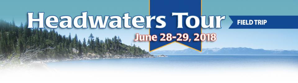
The Foundation’s Bay-Delta Tour
in May has already sold out but you can still join the
waitlist. Don’t miss out on the remaining opportunities
this spring and summer to visit important regions in the
state’s water story firsthand and engage directly with
water experts in California and from across the world.
Our Central Valley Tour, April
24-26, is nearing capacity! Only a few seats
remain on the bus for the tour that travels the length of
the San Joaquin Valley to explore the challenges of sustaining
one of the nation’s most productive agricultural regions.
Participants will visit farms and some of the state’s major
infrastructure, such as Friant Dam and San Luis Reservoir, as
well as the San Luis National Wildlife Refuge, a major
wintering ground and migratory stopover point for large
concentrations of waterfowl and shorebirds. Register here before
tickets are gone!
It’s rather amazing to ponder: As of this year, the Lower
American River Task Force (LARTF) has been meeting regularly
for the past 30 years. The task force is a unique collaborative
venue created in 1994 as a way for environmental, recreational,
community organizations, and others to learn about and engage
with local, state, and federal agencies on their efforts to
maintain flood control, environmental protection, and
recreation on the Lower American River Parkway. Its members
include representatives from federal, state, and local
agencies, environmental and recreational groups, water
suppliers, and other interested parties.
California’s water resources look promising thanks to a string
of cold, wet storms since January, but the state’s leaders are
eyeing how significant the payout from those storms will be for
future years. State officials and experts from the University
of California, Berkeley’s Central Sierra Snow Laboratory say
the Golden State’s water and snow outlook is looking good this
spring, despite a dry start to the water year. The milestone
snowpack survey of the year, conducted Tuesday at Phillips
Station in El Dorado County, found a snowpack measuring 64
inches and a snow water equivalent — water contained in the
snowpack — of 27.5 inches. … All state watersheds
have significantly improved in water storage since Feb. 20,
with all sitting at 90% or higher. The State Water Project also
increased its forecast allocation of water supplies to 30%.
Fog is central to life in California. … But climate
change is going to disrupt this quintessentially Californian
weather experience. We asked Todd Dawson, a scientist who has
long studied the relationship between fog and redwoods, to
divine the future of fog for us. Why does fog occur in
California, and why is it so important to the state’s
ecosystems? … Fog also provides an enormous, critical
water subsidy that sustains many coastal systems. Our coastal
fog has a high water content, so when it strikes surfaces such
as redwoods and grasses, it drips into the ecosystem. It
represents anywhere from 30–40% of all the water coastal
redwoods get each year.
As mining operations ramp up across Arizona, two massive
projects facing opposition from environmental groups and Native
American tribes have public comment deadlines in the coming
weeks. The Arizona Department of Environmental Quality is
accepting comments on the proposed Resolution Copper project
near Superior through April 7 and for the Copper World project
in the Santa Rita Mountains, about 30 miles south of Tucson,
through April 10. … Oak Flat sits over one of the
largest remaining copper deposits in the world. The mine would
sink more than 7,000 feet into the ground, where temperatures
reach 180 degrees Fahrenheit. It would require large quantities
of water for cooling, dust control to remediation of mine
waste.
Water for a thirsty Las Vegas has been building up over the
past month and a half and snowpack levels are 11% above normal
on April 1 — the date that snow normally peaks as warmer
weather begins to set in. … Two consecutive years above
normal snowpack levels is bucking the trend reported in a
July 2023 study that showed runoff has declined 10.3% over
the past 140 years because of increasing hotter
temperatures. Last year’s wet winter helped refill Lake
Mead and Lake Powell, the nation’s two largest reservoirs. But
they are still low. Lake Mead is currently at 37% of capacity,
and Lake Powell is at 33%.
[Denise] Moreno Ramírez wasn’t surprised when she heard an
Australian mining company, South32, planned to open a
manganese, zinc, lead and silver operation in the same area
where her family had worked. … But this latest proposed mine
was alarming, she said, because Biden is fast-tracking
it in the name of the energy transition – potentially
compromising the mountain’s delicate ecosystems, many of which
have begun to be restored as mines have shut
down. … A growing network of Arizona residents say
that allowing the mine to proceed as planned could introduce a
grave new layer of environmental injustices.
…Conservationists say they worry that South32 is seeking to
use water irresponsibly amid long-term drought.
As winter conditions wind down, the beginning of April is
always the most important time for California’s water managers
to take stock of how much snow has fallen in the Sierra
Nevada. This year, something unusual happened. After years
of extreme drought and several very wet flood years, the Sierra
snowpack, the source of one-third of the state’s water supply,
is shockingly average this year: 104% of normal on
Friday. And more is on the way.
On Sunday, California’s rainy season officially comes to an
end. … So, how did this wet season stack up? As of Tuesday,
California had received slightly more rain than usual this
winter — 104 percent of the average, according to state data.
The state’s snowpack, which accumulates in the Sierra Nevada
and typically provides 30 percent of the state’s water supply
for the year, is at 101 percent of normal for this time of
year. The state’s reservoirs are at an even higher 116 percent
of their normal levels, in part because they are still
benefiting from the back-to-back “atmospheric rivers” that
slammed California last winter.
National Weather Service (NWS) meteorologists shared a map on
social media that reveals which Southern California cities
will be hit hardest by an approaching storm expected to arrive
this weekend. California has faced an abnormally wet winter as
moisture-laden storms and atmospheric rivers dumped a deluge of
rain and snow on the state, beginning in January. The excessive
rainfall has resulted from a slew of atmospheric rivers that
have battered the state this month. Last year, more than a
dozen of them helped alleviate the state’s severe drought
situation and replenished many of the state’s reservoirs, but
the storms also caused devastating floods and landslides.
Spring is here, but the rainy season is clearly not
over in California. Two separate storms are poised to impact
the Golden State this week. The first one is predicted to
impact only Northern California on Wednesday, bringing light
rain. The second one is expected to sweep the
entire state over the weekend, likely delivering a shot of
moderate rain to Northern California and a more substantial
heavy soaking to Southern California. The National Weather
Service’s Los Angeles office is starting to sound the alarm
bells and called the system a “late season
significant storm” in its forecast.
A vast burn scar unfolds in drone footage of a landscape seared
by massive wildfires north of Lake Tahoe. But amid the expanses
of torched trees and gray soil, an unburnt island of lush green
emerges. The patch of greenery was painstakingly engineered. A
creek had been dammed, creating ponds that slowed the flow of
water so the surrounding earth had more time to sop it up. A
weblike system of canals helped spread that moisture through
the floodplain. Trees that had been encroaching on the wetlands
were felled. But it wasn’t a team of firefighters or
conservationists who performed this work. It was a crew of
semiaquatic rodents whose wetland-building skills have seen
them gain popularity as a natural way to mitigate
wildfires. A movement is afoot to restore beavers to the
state’s waterways, many of which have suffered from their
absence.
Near the California-Oregon border, reservoirs that once
submerged valleys have been drained, revealing a stark
landscape that had been underwater for generations. A thick
layer of muddy sediment covers the sloping ground, where
workers have been scattering seeds and leaving meandering
trails of footprints. In the cracked mud, seeds are sprouting
and tiny green shoots are appearing. With water passing freely
through tunnels in three dams, the Klamath River has returned
to its ancient channel and is flowing unhindered for the first
time in more than a century through miles of waterlogged lands.
When Kelly Dunham heard that water was gushing out from a test
well earlier this month for a proposed lithium mine in the
middle of this rural city of 900 residents, she went to see it
for herself. Water was surging from the drilling rig and
flooding the test site as berms trapped it and directed the
water toward lagoons once used by an abandoned missile launch
complex nearby. Trucks sucked up the water with pumps and
hauled it away to disposal wells as fast as they could.
The drill had hit pockets of carbon dioxide gas and more water
than expected, according to state regulators and Anson
Resources, the company behind the direct lithium extraction
(DLE) project in which brine is pumped from deep aquifers to
the surface, where lithium and other minerals are extracted
from the water before it is sent back underground.
… While the winter season may be drawing to a close, it looks
like California and the broader West will see at least one more
7-10+ day period of winter-like conditions beginning this
weekend. A series of 3-5 weak to moderate storms will affect
California in the next 10-14 days, bringing widespread
precipitation (especially NorCal) and cooler temperatures.
These appear to be fairly decent snow-accumulating storms for
the Sierra–no epic blizzards, but the highest elevations could
accumulate several additional feet over 10+ days and there will
likely be at least some accumulation to much lower elevations
at times. Widespread light to moderate rainfall is likely
throughout northern CA at lower elevations, and locally into
SoCal as well.
Some of California’s most treasured parks are threatened by
blight caused by pollution and climate change, according to a
pair of new reports. The four national parks with the highest
ozone levels are all in California, with Sequoia and Kings
Canyon National Parks topping the list of parks struggling with
air that’s dangerous to breathe, according to a recent report
by the National Parks Conservation Assn., an independent
advocacy group. Meanwhile, severe wildfires, drought and
sea-level rise are ravaging state parks, which encompass nearly
a quarter of California’s coastline, according to a separate
report by the California State Parks Foundation, another
advocacy group. … Behemoth sequoias and jagged Joshua
trees are among millions of trees across the state
succumbing to worsening wildfires, severe drought, extreme
heat, disease and other stressors that have been intensified by
global warming.
The Cocopah Tribe and two other Arizona tribal communities are
working with new money and tools to address climate change
after receiving grants from the U.S. Department of the Interior
and several private funders. In 2023, the 1,000-member Cocopah
Tribe, whose lands lie along the Colorado River southwest of
Yuma, received $5 million from the National Fish and Wildlife
Foundation’s America the Beautiful Challenge to support two
riparian restoration initiatives. During the four-year project,
the tribe will remove invasive species and replant 45,000
native trees, like cottonwood, willow and mesquite to restore
390 acres of the river’s historic floodplain close to the
U.S.-Mexico border. The Cocopah Tribe also received $515,000
from the U.S. Fish and Wildlife Service and the Bonneville
Environmental Foundation for the restoration effort.
The California Tahoe Conservancy joins with its funding
partners—the California Wildlife Conservation Board, Tahoe
Regional Planning Agency, California Department of Fish and
Wildlife, Tahoe Fund, and League to Save Lake Tahoe—to announce
the Conservancy is acquiring 31 acres of environmentally
sensitive land along the Upper Truckee River in South Lake
Tahoe. “This environmental acquisition may be the most
important in a generation to protect Lake Tahoe,” said
California Natural Resources Secretary Wade Crowfoot. “By
reconnecting the most important wetland that filters water
flowing into the Lake, this investment protects the Lake’s
precious water quality and also provides an important corridor
for local wildlife. This project demonstrates the great value
of the California Tahoe Conservancy, to work diligently over
years—sometimes decades—to see important environmental
improvements to fruition.”
California wineries appear to be complying with the Water
Board’s statewide Winery General Order’s winery wastewater
requirements, but the pace is slow, state statistics reveal.
And many are not in the compliance reporting pipeline at all,
data shows. (An overview page is provided here.) The order was
passed, the water boards said, for two major reasons. One was
because, “Winemakers requested the order to address the
statewide inconsistencies in permitting.” This request was from
large wineries that operate numerous facilities throughout the
state. (Smaller wineries opposed this in the public
hearings.) … As of Feb. 20, 2024, 201 wineries had
begun the process of filing, leaving a gap of 1,449 wineries
(the difference between 1,650 and 201, based on the initial
estimates).
All weather patterns must come to an end, and the setup that
allowed warm and dry conditions over much of the Northwest and
limited rainfall in California in recent days will wind down
later this week as a new train of storms lines up over the
northern Pacific, AccuWeather meteorologists
say. The storm train is not as intense as some episodes
over the winter, but with a breakdown of high
pressure over the Northwest and a southward shift in
the jet stream from the Pacific into North America,
there will be more opportunities for rain and mountain snow as
well as locally heavy precipitation that can slow travel on
highways and airports. … While a blockbuster snowfall is
not anticipated in the Sierra Nevada, the change to snow will
be more deliberate and add to the snowpack.
Although pesticides can rid your home of cockroaches or farm
fields of unwanted insects, they also can harm fish and
potentially even people, according to a new study from Oregon
State University. At high concentrations, these commonly
used pyrethroid pesticides, bifenthrin, cyfluthrin and
cyhalothrin, act as a neurotoxin for pests. … At low
concentrations, the pyrethroid pesticides disrupt fish’s
endocrine system, which produces hormones. The scientists
wanted to better understand how short of an exposure would harm
fish.
A network of artificial streams is teaching scientists how
California’s mountain waterways — and the ecosystems that
depend on them — may be impacted by a warmer, drier climate.
Over the next century, climate change is projected to bring
less snowfall to the Sierra Nevada. … In a new study,
University of California, Berkeley, researchers used a series
of nine artificial stream channels off Convict Creek in Mammoth
Lakes, California, to mimic the behavior of headwater streams
under present-day conditions and future climate change
scenarios.
Can Texas, New Mexico, and Colorado agree to a new
apportionment of the Rio Grande’s waters without the U.S.
government’s approval? The Supreme Court of the United States
is set to hear a case next week that may affect access to water
for millions of Americans — and set a precedent that could
impact millions more, as increased usage and climate change
further strain supply of the precious resource. … If
[the court sides with the states], the government might be
understood to have less weight to throw around in other
negotiations, such as the one that is also happening about the
Colorado River.
In early February 2024 the Mountain Counties Water Resources
Association adopted new forest management principles with the
goal of solving the ongoing problem and severe effects of
California’s mega wildfires. “Over 100 years of
suppressing wildfires and changing climate have produced
overgrown forests and catastrophic mega wildfires that are
impacting communities, degrading California’s headwaters’ water
quality, water infrastructure and forest resources in Sierra
Nevada watersheds, (ultimately) creating a toxic smoke health
hazard throughout the state,” MCWRA’s website
reads. “These severe mega wildfires release tons of
greenhouse gases and eliminate the ability of forests to absorb
and store atmospheric carbon,” the website continues.
Snowfall this week in the Rockies has improved the water
picture for the Colorado River, but one expert says she’s not
counting her chickens before they’re hatched. Current
information on the U.S. Bureau of Reclamation’s website shows
that snowpack levels in the Upper Colorado River Basin are at
110% of normal for this time of year. That’s an improvement
over March 1 when it was at 101%. … important weeks are
still ahead, even though the snowpack peak is typically
measured on April 1 each year.
The United States suffers the world’s second-highest toll from
major weather disasters, according to a new analysis — even
when numbers are adjusted for the country’s wealth. The report
released late last month by Zurich-based reinsurance giant
Swiss Re, which analyzed the vulnerability and damages of 36
different countries, suggests that weather disasters may become
a heavy drag on the U.S. economy — especially as insurers
increasingly pull out of hazardous areas. Those disasters are
driving up insurance rates, compounding inflation and adding to
Americans’ high cost of living. … Some insurers have
stopped offering home insurance policies in California, which
has seen numerous large wildfires in the past few years.
Growing up in the shadow of the
Rocky Mountains, Andrew Schwartz never missed an opportunity to
play in – or study – a Colorado snowstorm. During major
blizzards, he would traipse out into the icy wind and heavy
drifts of snow pretending to be a scientist researching in
Antarctica.
Decades later, still armed with an obsession for extreme weather,
Schwartz has landed in one of the snowiest places in the West,
leading a research lab whose mission is to give California water
managers instant information on the depth and quality of snow
draping the slopes of the Sierra Nevada.
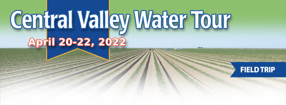
This tour ventured through California’s Central Valley, known as the nation’s breadbasket thanks to an imported supply of surface water and local groundwater. Covering about 20,000 square miles through the heart of the state, the valley provides 25 percent of the nation’s food, including 40 percent of all fruits, nuts and vegetables consumed throughout the country.
Land and waterway managers labored
hard over the course of a century to control California’s unruly
rivers by building dams and levees to slow and contain their
water. Now, farmers, environmentalists and agencies are undoing
some of that work as part of an accelerating campaign to restore
the state’s major floodplains.
On average, more than 60 percent of
California’s developed water supply originates in the Sierra
Nevada and the southern spur of the Cascade Range. Our water
supply is largely dependent on the health of our Sierra forests,
which are suffering from ecosystem degradation, drought,
wildfires and widespread tree mortality.
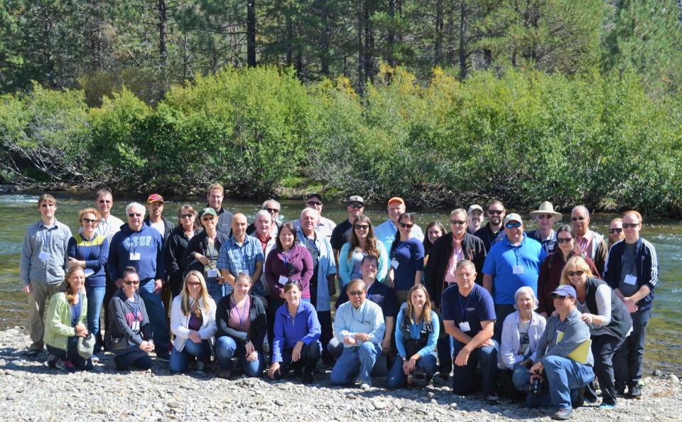
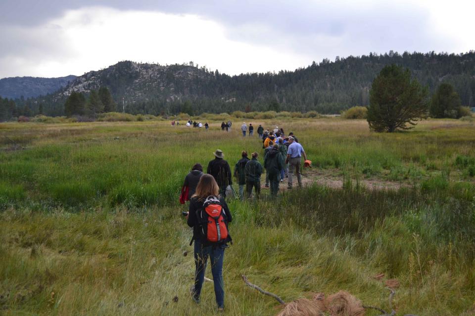
This tour ventured into the Sierra to examine water issues
that happen upstream but have dramatic impacts downstream and
throughout the state.
Many of California’s watersheds are
notoriously flashy – swerving from below-average flows to jarring
flood conditions in quick order. The state needs all the water it
can get from storms, but current flood management guidelines are
strict and unyielding, requiring reservoirs to dump water each
winter to make space for flood flows that may not come.
However, new tools and operating methods are emerging that could
lead the way to a redefined system that improves both water
supply and flood protection capabilities.
It’s been a year since two devastating wildfires on opposite ends
of California underscored the harsh new realities facing water
districts and cities serving communities in or adjacent to the
state’s fire-prone wildlands. Fire doesn’t just level homes, it
can contaminate water, scorch watersheds, damage delivery systems
and upend an agency’s finances.
The southern part of California’s Central Coast from San Luis Obispo County to Ventura County, home to about 1.5 million people, is blessed with a pleasing Mediterranean climate and a picturesque terrain. Yet while its unique geography abounds in beauty, the area perpetually struggles with drought.
Indeed, while the rest of California breathed a sigh of relief with the return of wet weather after the severe drought of 2012–2016, places such as Santa Barbara still grappled with dry conditions.
The majestic beauty of the Sierra
Nevada forest is awe-inspiring, but beneath the dazzling blue
sky, there is a problem: A century of fire suppression and
logging practices have left trees too close together. Millions of
trees have died, stricken by drought and beetle infestation.
Combined with a forest floor cluttered with dry brush and debris,
it’s a wildfire waiting to happen.
Fires devastate the Sierra watersheds upon which millions of
Californians depend — scorching the ground, unleashing a
battering ram of debris and turning hillsides into gelatinous,
stream-choking mudflows.
High in the headwaters of the Colorado River, around the hamlet of Kremmling, Colorado, generations of families have made ranching and farming a way of life, their hay fields and cattle sustained by the river’s flow. But as more water was pulled from the river and sent over the Continental Divide to meet the needs of Denver and other cities on the Front Range, less was left behind to meet the needs of ranchers and fish.
“What used to be a very large river that inundated the land has really become a trickle,” said Mely Whiting, Colorado counsel for Trout Unlimited. “We estimate that 70 percent of the flow on an annual average goes across the Continental Divide and never comes back.”
Each day, people living on the streets and camping along waterways across California face the same struggle – finding clean drinking water and a place to wash and go to the bathroom.
Some find friendly businesses willing to help, or public restrooms and drinking water fountains. Yet for many homeless people, accessing the water and sanitation that most people take for granted remains a daily struggle.
Even as stakeholders in the Colorado River Basin celebrate the recent completion of an unprecedented drought plan intended to stave off a crashing Lake Mead, there is little time to rest. An even larger hurdle lies ahead as they prepare to hammer out the next set of rules that could vastly reshape the river’s future.
Set to expire in 2026, the current guidelines for water deliveries and shortage sharing, launched in 2007 amid a multiyear drought, were designed to prevent disputes that could provoke conflict.
There’s going to be a new governor
in California next year – and a host of challenges both old and
new involving the state’s most vital natural resource, water.
So what should be the next governor’s water priorities?
That was one of the questions put to more than 150 participants
during a wrap-up session at the end of the Water Education
Foundation’s Sept. 20 Water Summit in Sacramento.
Water means life for all the Grand Canyon’s inhabitants, including the many varieties of insects that are a foundation of the ecosystem’s food web. But hydropower operations upstream on the Colorado River at Glen Canyon Dam, in Northern Arizona near the Utah border, disrupt the natural pace of insect reproduction as the river rises and falls, sometimes dramatically. Eggs deposited at the river’s edge are often left high and dry and their loss directly affects available food for endangered fish such as the humpback chub.
An hour’s drive north of Sacramento sits a picture-perfect valley hugging the eastern foothills of Northern California’s Coast Range, with golden hills framing grasslands mostly used for cattle grazing.
Back in the late 1800s, pioneer John Sites built his ranch there and a small township, now gone, bore his name. Today, the community of a handful of families and ranchers still maintains a proud heritage.
Amy Haas recently became the first non-engineer and the first woman to serve as executive director of the Upper Colorado River Commission in its 70-year history, putting her smack in the center of a host of daunting challenges facing the Upper Colorado River Basin.
Yet those challenges will be quite familiar to Haas, an attorney who for the past year has served as deputy director and general counsel of the commission. (She replaced longtime Executive Director Don Ostler). She has a long history of working within interstate Colorado River governance, including representing New Mexico as its Upper Colorado River commissioner and playing a central role in the negotiation of the recently signed U.S.-Mexico agreement known as Minute 323.
Sixty percent of California’s developed water supply
originates high in the Sierra Nevada mountains. Our water
supply is largely dependent on the health of our Sierra forests,
which are suffering from ecosystem degradation, drought,
wildfires and widespread tree mortality.
We headed into the foothills and the mountains to examine
water issues that happen upstream but have dramatic impacts
downstream and throughout the state.
GEI (Tour Starting Point)
2868 Prospect Park Dr.
Rancho Cordova, CA 95670.
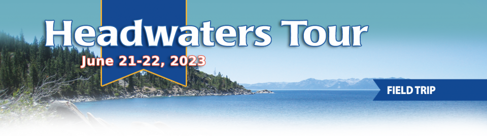
Lake
Tahoe, the iconic high Sierra water body that straddles
California and Nevada, has sat for more than 10,000 years at the
heart of the Washoe tribe’s territory. In fact, the name Tahoe
came from the tribal word dá’aw, meaning lake.
The lake’s English name was the source of debate for about 100
years after it was first “discovered” in 1844 by people of
European descent when Gen. John C. Fremont’s expedition made its
way into the region. Not long after, a man who carried mail on
snowshoes from Placerville to Nevada City named it Lake Bigler in
honor of John Bigler, who served as California’s third governor.
But because Bigler was an ardent secessionist, the federal
Interior Department during the Civil War introduced the name
Tahoe in 1862. Meanwhile, California kept it as Lake Bigler and
didn’t officially recognize the name as Lake Tahoe until 1945.
For decades, cannabis has been grown
in California – hidden away in forested groves or surreptitiously
harvested under the glare of high-intensity indoor lamps in
suburban tract homes.
In the past 20 years, however, cannabis — known more widely as
marijuana – has been moving from being a criminal activity to
gaining legitimacy as one of the hundreds of cash crops in the
state’s $46 billion-dollar agriculture industry, first legalized
for medicinal purposes and this year for recreational use.
As we continue forging ahead in 2018
with our online version of Western Water after 40 years
as a print magazine, we turned our attention to a topic that also
got its start this year: recreational marijuana as a legal use.
State regulators, in the last few years, already had been beefing
up their workforce to tackle the glut in marijuana crops and
combat their impacts to water quality and supply for people, fish
and farming downstream. Thus, even if these impacts were perhaps
unbeknownst to the majority of Californians who approved
Proposition 64 in 2016, we thought it important to see if
anything new had evolved from a water perspective now that
marijuana was legal.
California voters may experience a sense of déjà vu this year when they are asked twice in the same year to consider water bonds — one in June, the other headed to the November ballot.
Both tackle a variety of water issues, from helping disadvantaged communities get clean drinking water to making flood management improvements. But they avoid more controversial proposals, such as new surface storage, and they propose to do some very different things to appeal to different constituencies.
A new study could help water
agencies find solutions to the vexing challenges the homeless
face in gaining access to clean water for drinking and
sanitation.
The Santa Ana Watershed Project
Authority (SAWPA) in Southern California has embarked on a
comprehensive and collaborative effort aimed at assessing
strengths and needs as it relates to water services for people
(including the homeless) within its 2,840 square-mile area that
extends from the San Bernardino Mountains to the Orange County
coast.
Sixty percent of California’s developed water supply
originates high in the Sierra Nevada mountains. Our water
supply is largely dependent on the health of our Sierra forests,
which are suffering from ecosystem degradation, drought,
wildfires and widespread tree mortality.
ARkStorm stands for an atmospheric
river (“AR”) that carries precipitation levels expected to occur
once every 1,000 years (“k”). The concept was presented in a 2011
report by the U.S. Geological Survey (USGS) intended to elevate
the visibility of the very real threats to human life, property
and ecosystems posed by extreme storms on the West Coast.
Potable water, also known as
drinking water, comes from surface and ground sources and is
treated to levels that that meet state and federal standards for
consumption.
Water from natural sources is treated for microorganisms,
bacteria, toxic chemicals, viruses and fecal matter. Drinking
raw, untreated water can cause gastrointestinal problems such as
diarrhea, vomiting or fever.
The Eel River supports one of California’s largest wild salmon
and steelhead runs in a watershed that hosts the world’s largest
surviving stands of ancient redwoods.
The Eel flows generally northward from Northern California’s
Mendocino National Forest to the Pacific, a few miles south of
Eureka. The river and its tributaries drain
more than 3,500 square miles, the state’s
third-largest watershed.
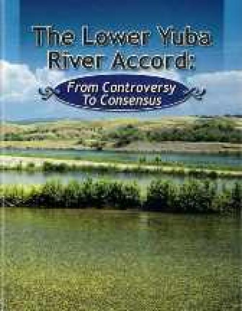
This 24-page booklet details the conflict between
environmentalists, fish organizations and the Yuba County Water
Agency and how it was resolved through the Lower Yuba River
Accord – a unique agreement supported by 18 agencies and
non-governmental organizations. The publication details
the history and hydrology of the Yuba River, past and present
environmental concerns, and conflicts over dam operations and
protecting endangered fish is included.
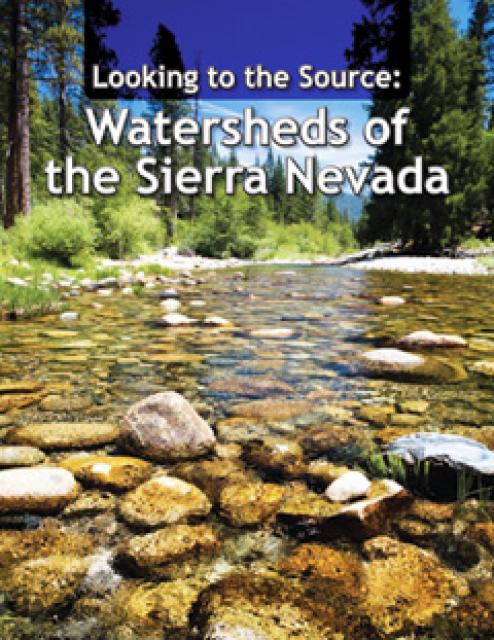
This 28-page report describes the watersheds of the Sierra Nevada
region and details their importance to California’s overall water
picture. It describes the region’s issues and challenges,
including healthy forests, catastrophic fire, recreational
impacts, climate change, development and land use.
The report also discusses the importance of protecting and
restoring watersheds in order to retain water quality and enhance
quantity. Examples and case studies are included.
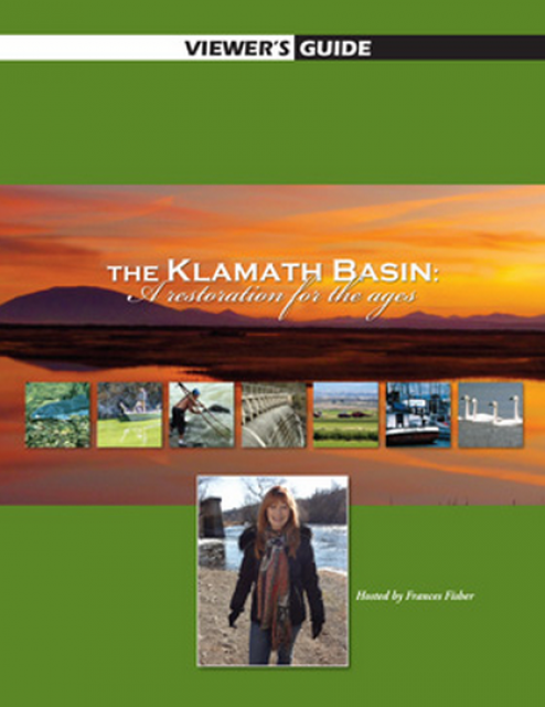
20-minute version of the 2012 documentary The Klamath Basin: A
Restoration for the Ages. This DVD is ideal for showing at
community forums and speaking engagements to help the public
understand the complex issues related to complex water management
disputes in the Klamath River Basin. Narrated by actress Frances
Fisher.
For over a century, the Klamath River Basin along the Oregon and
California border has faced complex water management disputes. As
relayed in this 2012, 60-minute public television documentary
narrated by actress Frances Fisher, the water interests range
from the Tribes near the river, to energy producer PacifiCorp,
farmers, municipalities, commercial fishermen, environmentalists
– all bearing legitimate arguments for how to manage the water.
After years of fighting, a groundbreaking compromise may soon
settle the battles with two epic agreements that hold the promise
of peace and fish for the watershed. View an excerpt from the
documentary here.
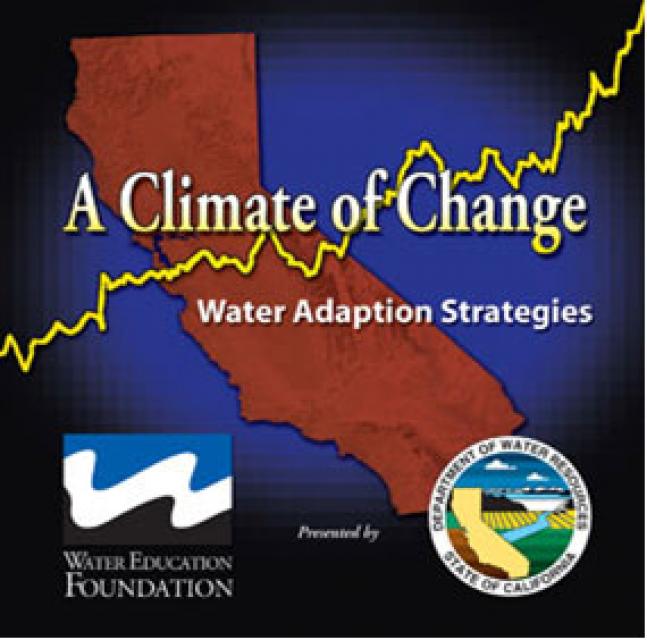
This 25-minute documentary-style DVD, developed in partnership
with the California Department of Water Resources, provides an
excellent overview of climate change and how it is already
affecting California. The DVD also explains what scientists
anticipate in the future related to sea level rise and
precipitation/runoff changes and explores the efforts that are
underway to plan and adapt to climate.
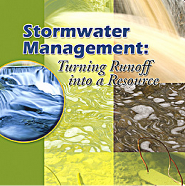
20-minute DVD that explains the problem with polluted stormwater,
and steps that can be taken to help prevent such pollution and
turn what is often viewed as a “nuisance” into a water resource
through various activities.
Many Californians don’t realize that when they turn on the
faucet, the water that flows out could come from a source close
to home or one hundreds of miles away. Most people take their
water for granted; not thinking about the elaborate systems and
testing that go into delivering clean, plentiful water to
households throughout the state. Where drinking water comes from,
how it’s treated, and what people can do to protect its quality
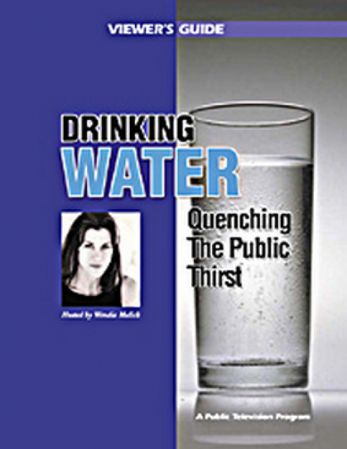
are highlighted in this 2007 PBS documentary narrated by actress
Wendie Malick.
A 30-minute version of the 2007 PBS documentary Drinking Water:
Quenching the Public Thirst. This DVD is ideal for showing at
community forums and speaking engagements to help the public
understand the complex issues surrounding the elaborate systems
and testing that go into delivering clean, plentiful water to
households throughout the state.
Water truly has shaped California into the great state it is
today. And if it is water that made California great, it’s the
fight over – and with – water that also makes it so critically
important. In efforts to remap California’s circulatory system,
there have been some critical events that had a profound impact
on California’s water history. These turning points not only
forced a re-evaluation of water, but continue to impact the lives
of every Californian. This 2005 PBS documentary offers a
historical and current look at the major water issues that shaped
the state we know today. Includes a 12-page viewer’s guide with
background information, historic timeline and a teacher’s lesson.
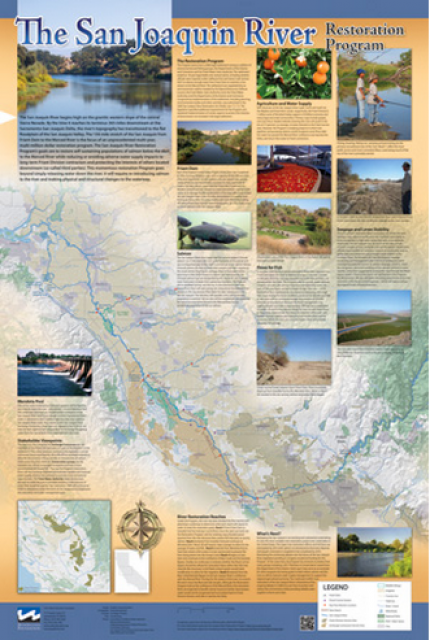
This beautiful 24×36 inch poster, suitable for framing, features
a map of the San Joaquin River. The map text focuses on the San
Joaquin River Restoration Program, which aims to restore flows
and populations of Chinook salmon to the river below Friant Dam
to its confluence with the Merced River. The text discusses the
history of the program, its goals and ongoing challenges with
implementation.
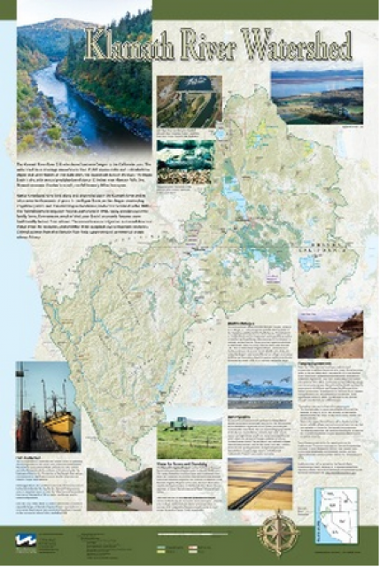
This beautiful 24×36 inch poster, suitable for framing, displays
the rivers, lakes and reservoirs, irrigated farmland, urban areas
and Indian reservations within the Klamath River Watershed. The
map text explains the many issues facing this vast,
15,000-square-mile watershed, including fish restoration;
agricultural water use; and wetlands. Also included are
descriptions of the separate, but linked, Klamath Basin
Restoration Agreement and the Klamath Hydroelectric Agreement,
and the next steps associated with those agreements. Development
of the map was funded by a grant from the U.S. Fish and Wildlife
Service.
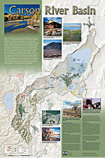
A companion to the Truckee River Basin Map poster, this 24×36
inch poster, suitable for framing, explores the Carson River, and
its link to the Truckee River. The map includes Lahontan Dam and
Reservoir, the Carson Sink, and the farming areas in the basin.
Map text discusses the region’s hydrology and geography, the
Newlands Project, land and water use within the basin and
wetlands. Development of the map was funded by a grant from the
U.S. Bureau of Reclamation Mid-Pacific Region, Lahontan Basin
Area Office.
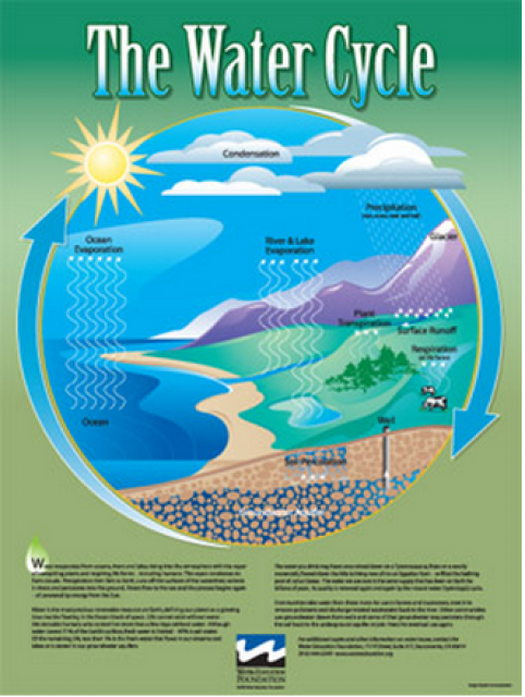
Water as a renewable resource is depicted in this 18×24 inch
poster. Water is renewed again and again by the natural
hydrologic cycle where water evaporates, transpires from plants,
rises to form clouds, and returns to the earth as precipitation.
Excellent for elementary school classroom use.
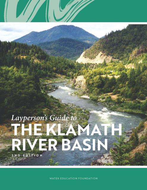
The Water Education Foundation’s second edition of
the Layperson’s Guide to The Klamath River Basin is
hot off the press and available for purchase.
Updated and redesigned, the easy-to-read overview covers the
history of the region’s tribal, agricultural and environmental
relationships with one of the West’s largest rivers — and a
vast watershed that hosts one of the nation’s oldest and
largest reclamation projects.
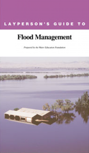
The 24-page Layperson’s Guide to Flood Management explains the
physical flood control system, including levees; discusses
previous flood events (including the 1997 flooding); explores
issues of floodplain management and development; provides an
overview of flood forecasting; and outlines ongoing flood control
projects.
A watershed is the land area that drains snowmelt and rain into a
network of lakes, streams, rivers and other waterways. It
typically is identified by the largest draining watercourse
within the system. In California, for example, the Sacramento River Basin is the
state’s largest watershed.
Southern California’s Santa Ana River is the largest watershed
drainage south of the Sierra and is located largely in a highly
urbanized, highly regulated setting.
At about 100 miles long and with more than 50 tributaries, the
Santa Ana spans parts of San Bernardino, Riverside and Orange
counties as it drains 2,840 square miles of land.
Drawn from a special stakeholder symposium held in September 1999
in Keystone, Colorado, this issue explores how we got to where we
are today on the Colorado River; an era in which the traditional
water development of the past has given way to a more
collaborative approach that tries to protect the environment
while stretching available water supplies.
Lake Tahoe is one of the Sierra Nevada’s crown jewels, renowned
for its breathtaking clarity. The high-altitude, clear blue lake
and its surrounding basin, which lie on the California-Nevada
state line, is a spectacular natural resource that provides
environmental, economic, recreational and aesthetic benefits.


")
")
")
")
")
")
")
")
")
")
")
")
")
")
")